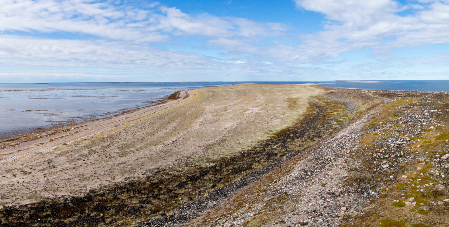
Physical Characteristics of the Area
The area surrounding Arviat and Arvia’juaq/Sentry Island, the Kivalliq region of Nunavut, is comprised of the inner coastal plain of the Hudson Bay Lowlands. The area is characterized by small lakes, and types of glacially formed gravel ridges called drumlins and eskers. One such esker (gravel ridge) extends from the small Inuit community of Arviat on the West Coast of Hudson Bay and ultimately forms the small gravelly island known as Arvia’juaq. The island was formed by glaciers that moved gravel and rocks into different formations, and many of the stone features we see on Arvia’juaq are made out of glacial till (gravel/rocks that the retreating glaciers left behind).
Due to this history of glaciation the area is experiencing a high level of isostatic rebound. Isostatic rebound is when land that has been pushed down under the weight of ice sheets rises up or bounces back after the ice sheets have melted. Many beach ridges on Arvia’juaq show that the area is rebounding significantly after the melting of the ice sheets.
The island remains mostly low lying, with the exception of a plateau with a steep cliff on the southerly side, upon which are a stone cairn and a wooden navigation beacon as well as a modern metal navigation beacon which was built in the 1980s. Arviat sits at a Longitude of 94° 04’ W, a Latitude of 61° 07’ N, and an elevation of 10m above sea level.

- McMartin, I., and L.A. Dredge
2005 History of ice flow in the Schultz Lake and Wagner Bay areas, Kivalliq region, Nunavut. Geological Survey of Canada Current Research 2005-B2. - Dawson, Peter, et al.
2007 Permit Report Number 07-004A: A Report on Archaeological Fieldwork Undertaken in 2007 at Kuuvik (JiKu-1; JiKu-2). Department of Archaeology, University of Calgary. - Simon, Karen M., et al.
2014 A relative sea-level history for Arviat, Nunavut, and implications for Laurentide Ice Sheet thickness west of Hudson Bay. Quaternary Research 82(1):185-197. - Birket-Smith, Kaj
1929 Report on the Fifth Thule Expedition 1921-24 1. Descriptive Part. W.E. Calvert, transl. Volume V. Copenhagen: Gyldeddalske Boghandel, Nordisk Forlag. - Henderson, Lyle
1995 Historic Sites and Monuments Board of Canada Agenda Paper: Arviaq and Qikiqtaarjuk. - Bertulli, Margaret
1990 Arviat Archaeology Project: Report of the 1989 Field Season. Prince of Wales Northern Hertiage Centre. - Canada, Statistics
2011 Census Profile: Keewatin, REG Nunavut (Census division). http://www12.statcan.ca/census-recensement/2011/dp-pd/prof/details/page.cfm?Lang=E&Geo1=CD&Code1=6205&Geo2=PR&Code2=62&Data=Count&SearchText=Keewatin&SearchType=Begins&SearchPR=01&B1=All&GeoLevel=PR&GeoCode=6205&TABID=1 - Freeman, Milton M.R.
2007 Aboriginal People: Arctic. Z. Parrott, ed, Vol. 2016: The Canadian Encyclopedia. - Heritage, Canadian
2000 National Historic Site Management Planning.